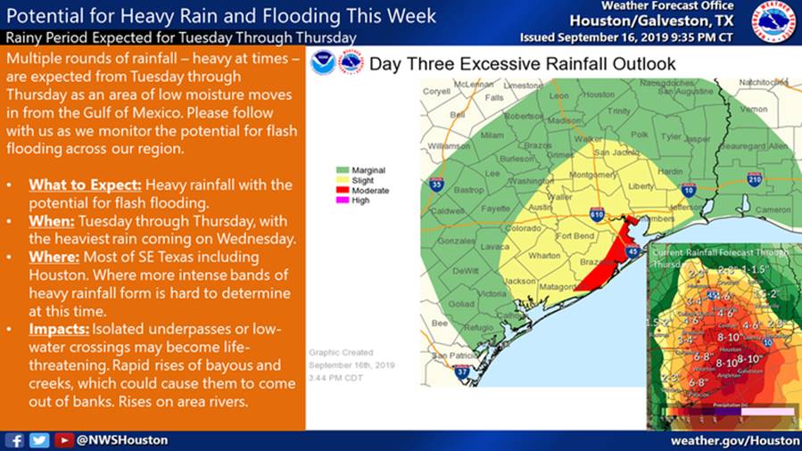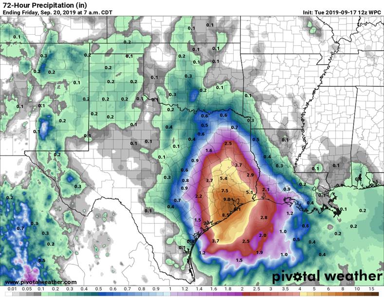
As you may be aware there is the potential for a heavy rainfall event and flash flood threat this evening through Thursday for SE TX. Based on National Weather Service local predictions, the heaviest rain is predicted to occur on Wednesday. Rainfall amounts of 5-7 inches are expected over much of the area with isolated totals of 10-12 inches. As a reminder to all residents, please keep your storm drains clear of debris and bring your trash cans in this evening. As the event continues through the next few days, we will continue to monitor rainfall levels and effects to the surrounding area.
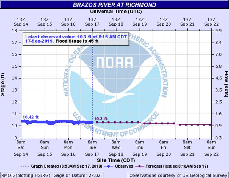
The Board and consultants are monitoring the storm system closely and will provide updates as needed. The operator is available and has staff ready for any operational needs within the District. Based on the current predictions and the current Brazos River levels, we do not anticipate needing to utilize the pump station, however it is operational should it be needed.
We encourage residents to continue to monitor forecasts for the area and follow trusted weather sources for information, recommendations and changes to the forecast. (Houston/Galveston National Weather Service and West Gulf River Forecast Center)