Weather Advisory
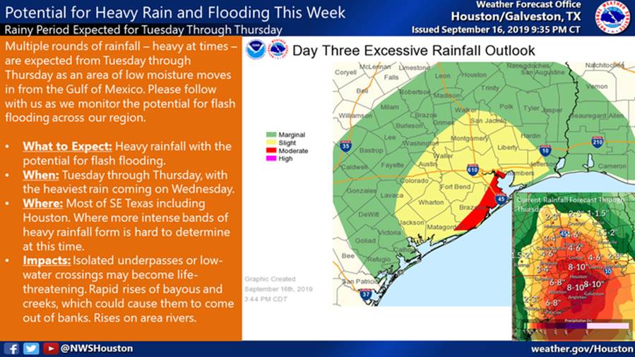
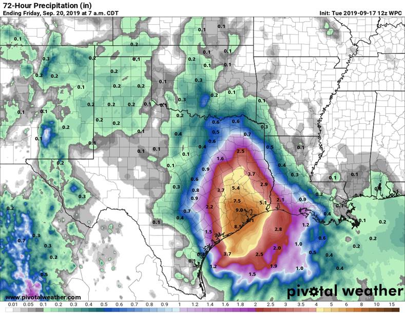
Weather experts tell us that conditions in the Gulf are becoming more favorable for a disturbance to develop into a Tropical Depression or a Tropical Storm later this week. It’s still early to predict, but meteorologists believe landfall along the upper Texas coast is possible.
Regardless of what happens, expect heavy rainfall this week and remember to secure loose items around your homes, keep storm drains clear and avoid parking in the streets because roads are designed to hold water during severe storms.
We’re approaching the most active part of hurricane season, so plan now. Visit our Emergency Management website for helpful preparedness resources.
Make sure to sign up for Flood Risk Alerts that provide near real-time rainfall and water levels. This service is provided through a partnership with the Harris County Flood Warning System. Stay alert and safe.
Other Helpful Sites
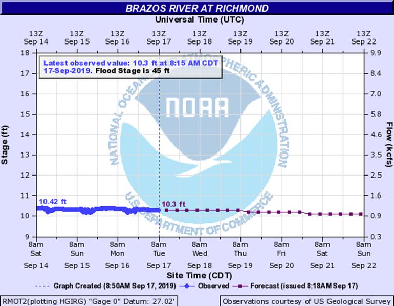
- Brazos River Forecast — Richmond Gauge
- Centerpoint Outage Tracker
- Emergency Management Website
- Flood Risk Alerts
- Levee Improvement Districts
- National Weather Service
- Rain Gauge Notifications
Please help us get the word out by sharing this information with your friends and neighbors.